Sussex Ouse Valley Way: Newhaven to Lewes
A few times now I've ended a walk at Southease station, and then have contemplated the possibility of walking on from there, following the River Ouse, into Lewes. For one reason or another I've always ended up deciding against this, and just getting the train instead:
- The first time was at the end of my first stretch of the South Downs Way, and having got out of practice for long distance walking prior to that my feet really hurt.
- The second time I was with friends who had a baby with them.
- The third time it was pouring with rain and I was in a rush to get back to London.
- The fourth time I had my daughter with me so didn't want to overdo it.

I decided to start more or less at the start of the path, and so took a train from London to Lewes, and from there on the little connecting line down to Newhaven. In fact the train from Lewes to Newhaven followed almost exactly the route I would be walking on the way back. It only takes 10 minutes on the train, but the walk back took close to three hours.

Newhaven at low tide on a grey day in November did not make for a very prepossessing start to the walk. I'm sure there are some nice parts of the town, but the immediate vicinity of Newhaven Town station was not one of them.
I have a feeling I've actually been to Newhaven once before, I think I took a ferry from here to Dieppe once on one of my school French exchange trips. None of it looked familiar though - I suppose that was likely around 30 years ago.

Today's route was fairly straightforward - as the name suggests, the Sussex Ouse Valley Way closely follows the route of the river Ouse - the one in Sussex. So I turned my back on the sea (which I didn't really get to see anyway, having alighted at Newhaven Town rather than Newhaven Harbour) and followed the river inland. Again I am sure there must be some nice parts of Newhaven, but I certainly didn't get to see any of them on my passage through the town - it mostly all looked rather bleak, just punctuated occasionally with slight maritime interest, like the rusting hull of a ship wreck, pictured above.


Somewhere on the outskirts of Newhaven I encountered the first sign posts for the S.O.V Way, and from then on I was into more open country. Albeit mostly rather bland, flat, and slightly bleak looking open country. The dreary weather really wasn't helping.

My eye was caught by this building which has a sort of moon base feel to it. It turns out to be Newhaven Energy Recovery Facility. As incinerators go I thought it was quite an attractive one.


From here on, the walk started to get a bit samey. This flat riverside path beneath the rather dreary grey skies characterised most of today's walk. It became a bit dull to be honest.


A brief respite from the monotony was provided by the little village of Piddinghoe, apparently once a smuggling port, which still retained a bit of character and charm. Albeit obviously not in its best light given the overcast skies today. There was a hint of sadness to the place too, given that it no longer had a pub, nor any shops. I didn't see a single person there as I passed through.

After Piddinghoe, the S.O.V Way diverts away from the river for a short stretch, and this diversion included a modest hill. That little bit of added height meant the views briefly improved. Although still obviously the dreary grey sky was doing its best to dampen the mood.


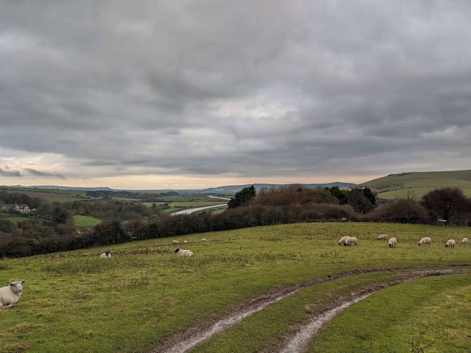
On reflection this diversion was probably the nicest bit of the walk. In this hillside field I passed, which offered views back down to the Ouse below, the flock of sheep were joined by a bouquet of pheasants (yes apparently that's the correct collective noun). I attempted to zoom in and get a picture of the pheasants but of course they were unhelpfully in the process of running away, and it looked a bit naff.


The diversion had been quite diverting. However, after that, it was back to the river, and the rather flat, unchanging landscape that immediately surrounded it. I'd rather hoped having the South Downs so close might make for better vistas today, but somehow the hills just got lost in the grey.
I'm sure the riverside sections of the route would probably make for a pleasant stroll on a carefree summer afternoon with blue skies overhead. Today though it just felt like a trudge.

Eventually I reached the bridge at Southease where the South Downs Way crosses the river Ouse. Actually the S.O.V again diverts away from the river here, to take in Southease, Rodmell and Monk's House. I had done at least some of this before though, when walking to Breaky Bottom, and as there was a shorter alternative here to just stay on the footpath alongside the river I decided to do that. It was also just before midday at this point, and I was looking forward to lunch at the Lewes Arms.

So from here on I was finally finding out what it was like to walk from Southease to Lewes. I can say that I do not regret my earlier decisions to just cheat and take the train.
Oh, and also this final section got really quite muddy.

I was amused by this piece of graffiti where the S. O. V. Way passes under the A27 on the outskirts of Lewes: "To all tha gangsta hikers".

Finally the chalky cliffs which are so striking in Lewes came into sight.

...and then more mud. Really quite a lot of mud.


There's some nice houses in this bit of Lewes (I think it's called Cliffe) lining the river.

One final sign post for the Sussex Ouse Valley Way, and I was in Lewes.

Once back in Lewes I headed for the excellent Lewes Arms, which was a very welcome reward after today's often dreary trudge.
Comments
Post a Comment