Shipwrights Way and Hangers Way: Liss Circular
Today's walk was largely planned around a craving to go to the Harrow Inn at Steep, near Petersfield. Of course, I could have just taken the train to Petersfield and walked the 20 minutes each way to get to the Harrow Inn, but that didn't seem like much of a challenge. So instead I decided to start and end my walk at Liss, roughly following the Shipwrights Way on the way to Steep, then some of the Hangers Way on the way back.
Much of the section of the Shipwrights Way I followed is along roads, first a stretch to get out of Liss, then a pleasant little country lane called Stodham Lane. At the other end of this it joined another country lane, and passed Stodham Park.
The way then turns off the road onto a private road / track with steep sides, a very old looking moss covered stone wall on one side. This was quite a nice stretch of the route.
The route crosses over the railway, then follows alongside the A3 for a bit, which was obviously somewhat less pleasant, but thankfully only lasted a few minutes.
After crossing the A3, there was then only a short stretch of footpath to reach the edge of Steep, where I was greeted by a picturesque cottage beside the Ashford Stream.
Then onto the highlight of today's walk - the wonderful Harrow Inn. I arrived around 12:10 but the main bar room was already close to full (it's tiny, so it only takes about 12 people to fill it).
I was particularly impressed by how tasteful the Christmas decorations were - no plastic tat here - all handmade and natural, with dried flowers hanging from the ceiling, and wreaths and other tree and plant derived assemblages adoring the walls. It was an absolute delight.
Loathed though I was to leave the Harrow Inn, I thought I probably should press on with my walk, and so headed north out of Steep to join the Hangers Way. This first passed through a bit of "Ancient semi-natural English woodland", according to the sign (Northfield Wood on the map) before skirting round a large field.
On the other side of the field I was treated to a gushing water fall - I believe formerly there was a water mill here, as I entered the Little Langleys conservation area.
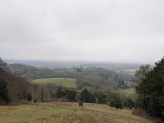
It was really quite steep! Almost a 100m climb, with the contour lines very close together on the map.
It did give far reaching views, although of course today's weather wasn't really ideal for enjoying these views to their full potential.
I stopped for a bit at the top to catch my breath, cool down a bit, and drink some water. Probably the views were actually slightly clearer from about three quarters of the way up, where there weren't quite so many trees in the way.
Thankfully once at the top that was pretty much all the climbing I had to do for the remainder of today's walk. Having satisfied myself I had done a reasonable amount of exercise from here I essentially headed back in the direction of Liss.
Another viewpoint a little further along - Cobbett's View, was even more impaired by the weather than the Shoulder of Mutton viewpoint had been. So I didn't linger long here.
I picked up the pace a bit for the remainder of the walk, and only took a couple more photos (the scenery wasn't particularly conducive to it anyway), keen to make the 14:58 train from Liss. A country lane, followed by a handy section of bridleway, then another country lane, over the A3 junction, and I was back in Liss once again.


Comments
Post a Comment