Since completing the Ridgeway last summer, I've been thinking about which long distance path to do next. The Ridgeway's lesser known cousin - The Wessex Ridgeway - seemed like an obvious choice, which offers continuity as well as the opportunity to explore some areas of the country I'm less familiar with. It starts in Wiltshire and then heads over the border into Dorset, and I think even briefly crosses into Devon, and ends by the sea at Lyme Regis.
The plan is to try and do the whole 137 miles this summer, and to try and do bigger chunks each time, inspired by the two day hike I did when I completed the Ridgeway. I looked at various ways to split it into sections, and what seemed to make sense was to plan for a number of two day sections which start and end at train stations, aiming to cover about 15 miles a day. That would mean nine days of walking in total, so one of the sections might be an even more ambitious three day hike - but we'll see if that actually comes to pass.
For the first section, I planned a two day walk (about 30 miles, or 50 kilometres), starting at Avebury, ending at Westbury. Yes, I know technically the Wessex Ridgeway starts at Marlborough, but in my mind Avebury seems like a much more logical place to begin. For one thing it's where the Ridgeway ends (or begins, depending which way round you do it), but also assuming the Wessex Ridgeway is an attempt to recreate the route taken by people in the Neolithic to get from the South West to the monuments of Avebury and Stonehenge, it surely makes more sense for the terminus to be one of those sites.

It was a bit of a late start, having been preoccupied with other things the day before, so I did much of the preparation in the morning of the first day, and didn't make it to Avebury until about 1:30. Still, that did at least make it well timed for a hearty lunch at the Red Lion before setting off. Avebury looked glorious in the hot and sunny weather. Having previously been there for an unseasonably cold and grey summer solstice it felt a bit of a missed opportunity to march straight out of the village after lunch, but I was mindful of the fact I had at least six hours walking ahead of me, and thought I had better press on.


Despite having visited Avebury a number of times, previously I'd only really focused my attention on the stone circle (oh, and the pub) and hadn't wandered around the village itself much. So despite my fleeting visit on this occasion, the fact I'd be leaving the village to the west today meant I could see more of Avebury's actual houses, and what a pretty collection of dwellings they are, with their thatched roofs and vibrant floral displays out the front.
To begin with, on leaving Avebury, the Wessex Ridgeaway roughly follows the route of the Beckhampton Avenue. Once this was an impressive stone lined avenue of a similar style to the West Kennet Avenue to the south, but alas now only two stones remain standing. Again I didn't linger for very long here, and felt I didn't quite do this pair of survivors justice, but it was a bit unclear whether this field was open access, and, again, with a long walk ahead of me I felt compelled to press on.
After this, the trail roughly follows the A4 for a while, before taking a sharp left at a tumulus...
...and heading up and over Cherhill Hill. A name I find a little perplexing - shouldn't it just be Cher Hill?
Beyond Cher-Hill-Hill the route follows a Roman road for a while, and, if Alfred Watkins is to be believed, many of these were built on pre-existing "old straight tracks". This particular Roman road is part of the London to Bath route, which eventually became the A4. Both of those end points do seem quite intrinsically Roman, so perhaps this particular road doesn't have a pre-Roman origin. The section I walked along today runs alongside Baltic Farm, another area of Neolithic interest I probably should have stopped to inspect more closely - there's a collection of tumuli here, and the Wansdyke also runs through one corner.
Then up Morgan's Hill. After the numerous items of ancient historical interest in the past couple of hours there was something of a jarring contrast the other side of Morgan's Hill in the form of North Wilts Golf Club.


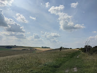
The next hour presented rather a long slog in the oppressive heat across Roundway Down, the site of a battle in 1643 during the civil war. At the other side of Roundway Down I permitted myself a break, sat on a rusty bench for a while, and decided to lighten the load by emptying out my "hydration pack" thing (also known as a "water bladder"). They're really hard to clean, and I had a nagging doubt I might not have done so as thoroughly as I should have. It had an unpleasant taste, exacerbated by the plastic and the fact the whole thing had been heated up by the sun for the past few hours. Realising I'd soon be passing through Devizes it seemed a much more sensible plan to replenish water supplies there, rather than lugging 4 litres of water about, and I wished that had occurred to me earlier.


I did not linger in Devizes, stopping only briefly to get more water. Beyond Devizes I marched purposefully through and on towards Urchfont. The route to get there passed Etchilhampton Hill and the enigmatically named village (more of a hamlet really) of Stert, before a slightly hair raising traversal of the railway tracks, and then a further brush with danger beyond there in the form of a menacing herd of cows. The aforementioned ruminants chased me out of their field, although alas I have no photographic record of this incident, I thought it best to focus instead on getting over the fence the other side as quickly as possible.
The sun was starting to hang a little low in the sky, and it was a little after 8pm by the time I arrived in Urchfont to the sound of church bells, which was very atmospheric.
I paused for a little while at the village pond for a rest, and briefly considered going to inspect the village pub, but there was by now less than an hour to go before sunset, so I thought it best to press on.
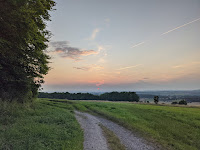
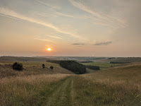
I watched the sun gradually setting behind me as I climbed Urchfont Hill. I'd noticed on the map there was a small copse at the top, and rather naively imagined there would be nobody about by this time of day, such that I might get away with bivvying down there for the night. What I'd failed to realise is that the Imber Perimeter Path at the top of the hill - which follows round the edge of the military training danger area - is a byway which cars can easily access. There were several people parked up there, presumably out to watch the sunset. So that rather scuppered that plan.
I was a bit at a loss as to what to do at this point, and thought I should just continue to follow the route of the Wessex Ridgeway, hoping that I might figure something out.
I eventually found a spot, which, thanks to the fact it was now quite dark, seemed discreet enough, and stopped here to boil a bit of water on my camp stove so I could rehydrate dinner: The Summit to Eat macaroni cheese, which again was surprisingly good.
This all seemed to be going quite well to begin with, but then after a while some helicopters started circling overhead. I was outside the military danger area (there's obviously no way I'd go in there!), some distance from the perimeter in fact, but presumably they were doing exercises this evening, and the helicopters had something to do with that. It wasn't clear to me whether their circling overhead was somehow an attempt to indicate I shouldn't be there - I was just sat beside a public byway, I wasn't aware these have any hours of acceptable use - but either way they were making quite a racket, and there was no way I was going to get any peace and quiet there. So I decided to head back down the hill, towards Market Lavington, without a particularly clear idea of what I was going to do when I got there.
I briefly looked into whether any of the local pubs might do accommodation, but it was already around closing time by the time I got to Market Lavington, and the first pub I got to definitely didn't have any rooms. So I just kept on walking really, and eventually rejoined the Wessex Ridgeway a little way beyond West Lavington.
Fortunately the route of the Wessex Ridgeway diverts away from the Imber Perimeter Path for a while, and with a good couple of hills now between me and the military training area I figured I'd stand a better chance of finding a place to rest for a few hours until first light, without being disturbed by helicopters. Finally at around midnight I came to a spot with a bit of cover, just off the path.
Bivvying - essentially sleeping in a big waterproof bag rather than a tent - can barely be described as camping, it's just lying down on the ground for a bit. As it was such a warm night and the ground wasn't too hard or stoney I didn't bother with the sleeping pad, which is a bit of a faff to inflate, and barely used my sleeping bag / quilt thing either - pretty much just the bivvy bag, with my backpack as a pillow.
I obviously didn't get a great night's sleep this way, but I think I must have dozed on and off a bit - I remember hearing a distant church bell chiming at 3am, but don't recall the 4am chimes. I was quite prepared for the fact I wouldn't sleep much, and really this was just a practical alternative to trying to walk in the dark, which wouldn't have been very sensible given the uneven terrain.
I got up at first light, or at least when I perceived that to be the case, around 4:30am, and set on my way once again. Breakfast consisted of a cereal bar and a swig of water.
I felt really pleased with myself for being up at dawn and straight back on the trail like this. Unfortunately the downside of this early start was that I fell into almost exactly the same trap as
my previous two day hike: despite it having been a warm and dry night, the grass was still dewy, and my boots (which aren't as waterproof as they claim to be) got wet. This in turn made my socks rub against my feet, and added to the fact I'd ended up walking over 20 miles the previous day, it meant my feet eventually got really sore indeed, just like last time.
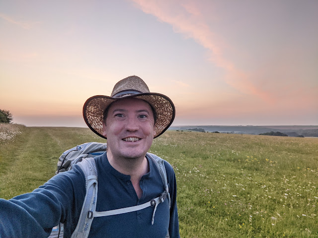
Still, despite knowing the discomfort which was inevitably to come, I enjoyed this early section of today's walk, watching the sunrise as I went.


Eventually the route of the Wessex Ridgeway once again joined the Imber Range Perimiter Path, which after last night's shenanigans I cannot say I have much affection for. If I'm honest the rest of today's walk was really a bit of a trudge, without much reward in terms of the scenery, and with my feet getting ever more painful as I went.
The one thing which did cheer me on throughout the latter part of this footslog was the scabious - there seemed to be a riot of it all alongside the track, and it was looking particularly pretty, especially in the early morning light.
...and while we're on the subject of scabious, here's some more from the previous day. I think these are all field scabious -
knautia arvensis - What a pretty flower it is, despite the fact the name apparently derives from the fact it was used to treat scabies.
I made it to the end of the trudgery of all the boring tracks a little after 8am, when I reached the top of Westbury Hill. I decided to give myself an extended break here, and sat for around half an hour, before gathering my strength for the final descent into Westbury.


Those last two or three miles were really a hobble, and I was relieved when I finally reached Westbury station, where I could take off my boots for a bit while waiting for my train back to London.
So, in summary, what did I think of this first section of the Wessex Ridgeway? It started well, and apart from the fact it was a bit too hot - which you can't blame the path for (albeit that it lacks shade) - it was pleasant and interesting enough as far as Roundway Down. In fairness I did take a shortcut across Roundway Down - I can see that section might have seemed a bit less of a featureless trudge had I followed the route around Oliver's Castle. The route passed through some towns and villages of varying interest. Perhaps it's unfair to judge Devizes by the bit I saw, which had a definite edge-of-the-town feel to it. Urchfont however was very pretty, the sort of place people probably call a "quintessential English village".
I think my main objection to this part of the route was how much of it followed the Imber Perimiter Path - skirting round the edges of the military danger area. I get that given the huge expanse of military training area on Salisbury Plain that's hard to avoid, but something about the constant warning signs on one side of the track made it all feel a bit grim and bleak - even though the sun was shining the whole time.
The next section I am planning to do - Westbury to Tisbury - looks like it suffers a similar fate of struggling to escape the orbit of the danger area, but it does eventually manage it as the route heads to Cranborne Chase, and hopefully from there on it's more free and open countryside.


Comments
Post a Comment